Sunday, October 1, 2017

Heading Home

Well, I'm sitting here in Odessa, Missouri (30 miles east of Kansas City) at the same campground we stopped at on July 4th, 3 months ago, the second stop on our trip.  By the way, Welcome To Kansas City!


I think we can draw a few conclusions from this.

1.  We are clearly on our way home and our trip is almost over!

2.   "We done good" for a couple of rookie RVers. We had a very general plan to be out about 3 months and a general idea of a route that we thought would work, but we did not make a single reservation in advance of more than a few days and "winged" the whole trip.  There were a couple of times we were almost desperate for a place to stay close to where we wanted to be but it always worked out. 

3.  Sometimes it's better to be lucky than good!  The 3 month thing - we have 2 more days of travel and should be home on Tuesday which will be October 3rd, EXACTLY 3 months since we left on July 3rd.  I think that might be a little bit of luck though because we darn sure didn't plan for that to be 3 months to the day!

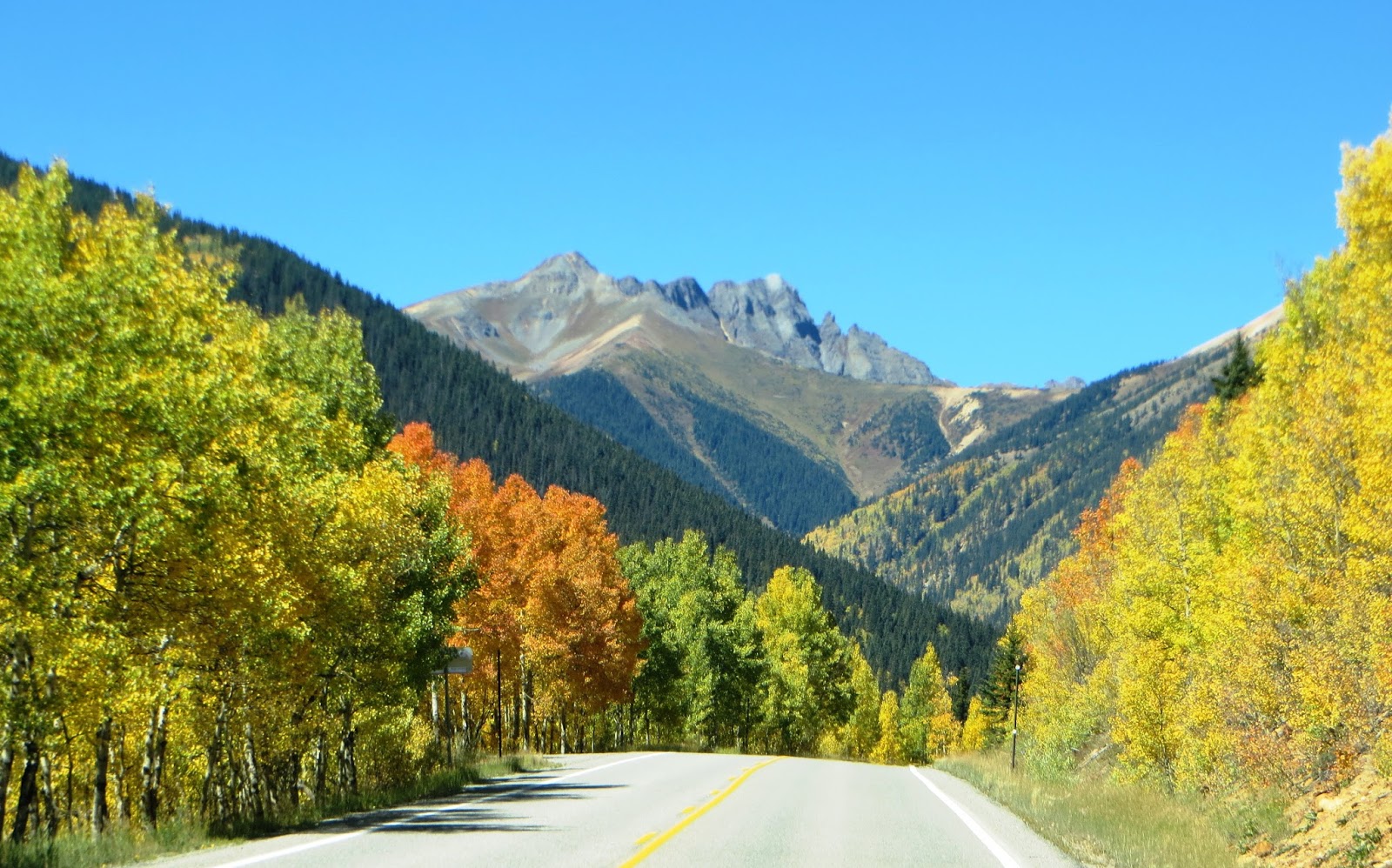
Anyhow, a little closure on our last stop in Colorado.  If you recall, cold temps, wind, and rain (mostly rain) were hampering our CO adventures and that did not stop at Colorado Springs.  After not getting to ride the #1 motorcycle ride (San Juan Skyway out of Durango), I was determined to ride the #2 ride which is west and northwest of Denver which would have been another 2-day overnight trip.  Well that didn't work out either. We stayed in Colorado Springs for 5 days and ended up with 2 days of sort of decent weather.  On one of those days, I had about 6 hours of good weather forecast so I developed my own 183-mile ride to try and keep me in the valleys because of cold temps and a very low overcast at the higher elevations.  I included a stop on the Arkansas River since we lived aboard "Help Me Rhonda" on the river at Three Forks Harbor in Muskogee, OK for 2 and 1/2 years.  I knew the river originated in Colorado and I found a good spot about 100 miles downstream of the origin to take a look.  Looking north and south below.  For those not familiar, it's a good bit bigger than this down at the lower end where it dumps into the Mississippi River!  It's a major waterway with lots of barge traffic as far inland as Catoosa, OK (almost to Tulsa).


Those are the only pictures I took - just wanted to enjoy the ride with the short amount of time I had.  Somehow in my planning for the ride though, I had missed one thing.  As I was about 2/3 through the ride, I began to notice aspens turning yellow, the temps getting colder, and the wet overcast getting closer to my head???  All three of those made sense when I saw the sign for "Wilkerson Pass - 9507 feet."  It was wet and very cold for about an hour but at least I got a ride in before leaving Colorado.

On the other "sort of decent weather day" we decided to tour what you could see of the Air Force Academy.  You think I'm kidding about the weather?  Here's probably the most photographed structure there, the chapel.


That's not a bad picture.  It's just cold wet fog all the way to the ground.  But the inside was pretty.  Coincidentally, the couple in the photo are from Alabama and live about 20 miles from us!


Pipe organ at the back.


The cross was simple but beautiful and had an aerodynamic winged look to it, and I don't say that in any way to minimize the significance of the cross.  Just thought it was an interesting coincidence, probably even planned that way.  Get it? Aerodynamic, WINGed - Air Force Academy?


A visitor to the Air Force Academy does not have access to much of the campus (mainly the visitor center and the chapel), so we checked out the info there including an informative video about a cadet's time at the academy, took what few pictures we could and headed to "The Garden Of The Gods" - a drive-thru city park that is probably pretty impressive if you could see it.  Again the weather was a problem.


It was kind of like "Valley Of Fire" (in Las Vegas) with trees (and fog).


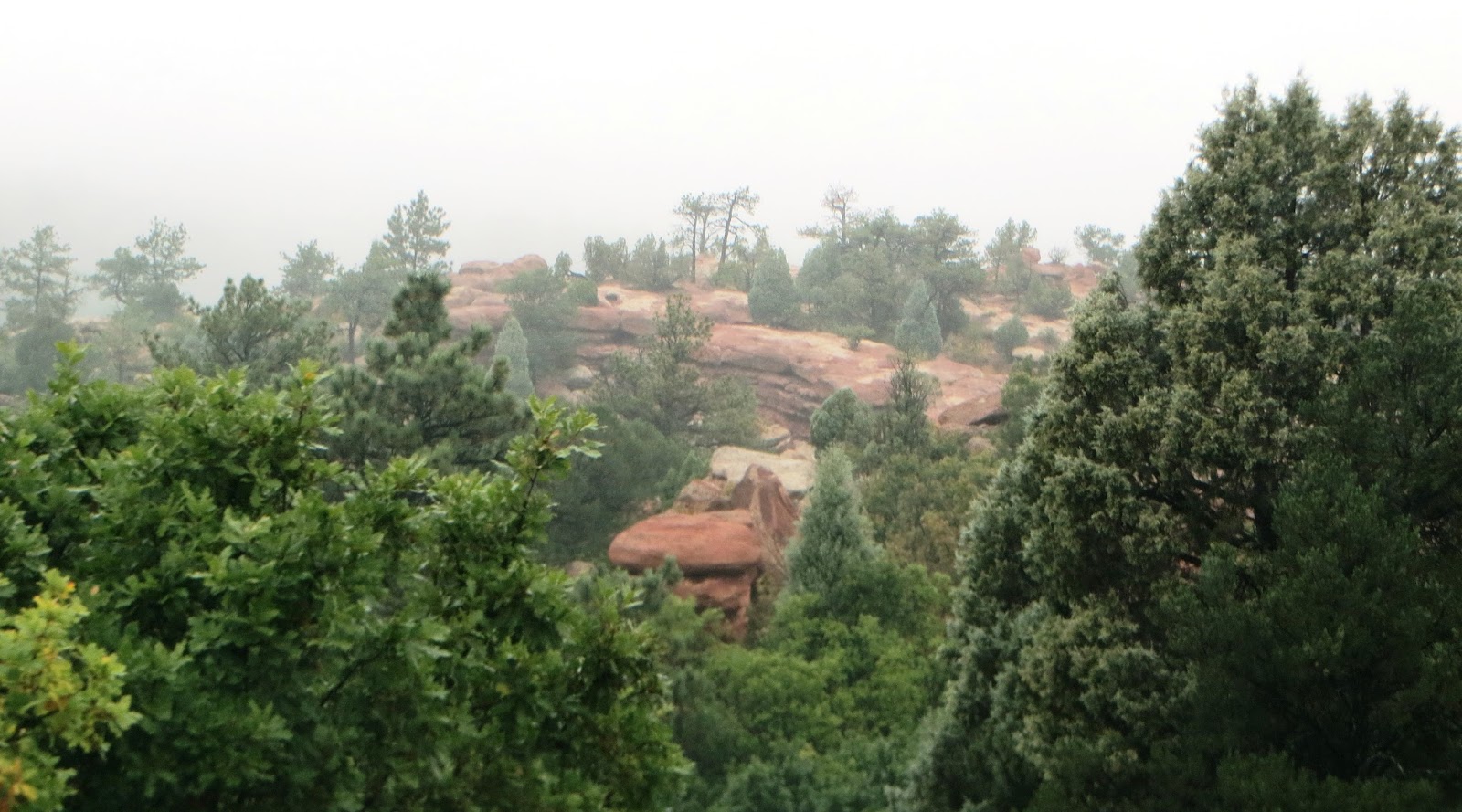
So, we missed Pikes Peak (nothing to see at that altitude but clouds and lots of snow) and a few other possibilities, but like I said previously, we have really been blessed on this trip with safety and great weather except for Colorado.  Driving across Kansas was sort of dull and boring so I think I'll close it down here.  

We have had a wonderful time, thankful for the opportunity, the safe travels, and the memories.  We bought magnets when they were available to help with that memory thing!


We are also glad that many of YOU, our family and friends, joined us - thanks for your interest and comments.  I will probably put some stats and lessons learned together later, but for now we are a bit tired, ready to be home.  Hey we only covered 19 states, 3 time zones, 11,624 truck miles (towing and sightseeing), and 3572 motorcycle miles!!!!!

So long for now.


Love y'all!  Life is good.  Thank you, Lord.


Wayne and Rhonda

Monday, September 25, 2017

Hello Colorado - San Juan Skyway and Great Sand Dunes


We are glad to get a welcome from any state, but does anyone else see the problem with this sign?  It says "COLORFUL" Colorado, but there's not a bit of color in the sign or the landscape around it!

Colorado has not been particularly helpful with our travels so far. To start with, the campground we selected close to Durango/Vallecito did not turn out to be what it advertised, so we left and relocated to another spot in Ignacio (good move by the way and very thankful something else was available on such short notice).  And, ever since we arrived in Colorado, it has been cold and windy and we have had more rain in Colorado than all of the rest of our travels over the past 2 1/2 months combined.  We have had near perfect weather since we left home in early July and we are thankful for that, also for safe travels.  So, we are not complaining but a lot that we had planned for Colorado, so far has not been possible.

One of the reasons we initially chose Durango as a good location was because it is located on the #1 motorcycle ride for the state.  I had a one-day weather window to get that 220-mile ride in, but the wind was 20 to 30 mph, gusting to 40, so Rhonda and I rode it together in the truck.  Since that one-day window, it has been raining and snowing with very cold temps, so much so they even opened their ski slopes at Silverton earlier than usual, and the forecast for the next week was for much of the same.

So let's start with that truck ride on the San Juan Skyway.  Mid-September to mid-October is the best time of the season for the aspens and other fall colors.  Oh baby - it was stunningly beautiful.  We took 192 pictures, and I have never had so much trouble deciding which ones to post.  Here's what I came up with.  Enjoy.


We thought aspens were always yellow in the fall, but they can also be orange and sometimes even red.  (Did not see any reds).


Even the stream put on its fall colors.


One stretch of the roadway is referred to as "The Million Dollar Mile Highway," referring (supposedly) to the cost per mile.  Unfortunately though, for each million of highway costs, it did not come with guardrails.  As you can see below, what were they thinking?


But they added a little treat - a steel platform that hangs in the air above a waterfall. The platform is grated steel, so you can look straight down through the platform. Rhonda's checking it out and appears to be making progress with her fear of heights after this trip! (From Rhonda: My fear is not from heights, but from heights without guardrails!)


The waterfall below, "Bear Creek Falls," and note the clear water in the pool at the bottom.


There are two towns on the route we covered - Silverton and Ouray (pronounced Youray).


Ouray is known for it's quaint and pretty homes.


Ski slopes, Telluride and Purgatory, are also on the route. We only passed by Purgatory.


With the weather forecast to get worse for the next week, we saw no reason to hang around and moved on to Alamosa to tour the Great Sand Dunes National Park.  It's a little hard to see in the picture, but we had a beautiful view of the mountains from our RV park in Alamosa.


It was rainy, windy, and cold there also, but we were treated to a special double rainbow after a day of rain, probably the most brilliant rainbow colors we have ever seen.


The double rainbow below.


We only had about half of one day with weather good enough to tour Great Sands, but even then it was still windy and cold, and we had to bundle up a bit.  Now if it's windy and cold, you may be wondering why Rhonda is barefoot.  With blue skies and sunshine, the medium-dark sand soaks up the sunshine and the top layer of the sand was pretty warm (so she says).


The down side to that was having to cross Medano Creek to get to the dunes.  Here she goes.  


By the way, the depth of Medano Creek is a seasonal thing - about one foot deep during the spring snow melt, eventually going dry in June. So, while the rainy weather has impacted our plans, without it we would not have been able to see Medano Creek.  Those of us who kept our shoes on were able to selectively plan our crossing and stay dry.  An entire "shoed" family was debating the crossing when I got to the bank and they asked, "Can you cross without getting your feet wet?"  I thought the appropriate answer was "Depends on where you step!" 

So, here's the short version on The Great Sand Dunes.  The predominately SW wind blows across the huge and very sandy San Luis Valley, picks up the sand and deposits the majority of it in a relatively small 41,000-acre area in a mountain basin.  (The total dune area is 149,000 acres.) The 41,000-acre area is 750 feet tall and sits on a large aquifer formed by the snow melt.  The runoff is absorbed by the sand until saturated and the overflow forms the creeks that surround the dunes and run into the valley.  The creeks pick up lots of the sand and carry it back into the valley, only to be picked up again by the SW winds........ you get the idea.  Below -  the valley, the dunes, and the snow-capped mountains.


In the close-up below, you can see Medano Creek on the east side of the dunes.  There's another creek on the west side. And of course, the beautiful aspens below the snow line.


You get a feel below for how far the valley extends in the distance.


Rhonda on the way up the hill with only about a mile and 700 vertical feet to go.  I talked her out of it, and we headed back to the truck where there was heat and no wind.


And we got a nice shot of another snow-capped mountain on the way back to the RV.


That's about it for Colorado so far, hoping for better weather in Colorado Springs.  We'll give it 5 days and then we need to head back home.  Later.